Transfagarasan Alpine Road Trip
(July 2010)
So, after several attempts and plans to start this journey, we finally did it !
Why so ? Because, being an alpine road, Transfagarasan is opened for public only 3 months a year and many of our weekends where fulfilled with other things.
Tranfagarasan = prefix "trans" + "Fagaras" - it is probably the most spectacular road from Romania; called also "drumul din nori" ("the clouds road"), it links the historical romanian regions of Muntenia and Transilvania, over the Fagaras Mountains, Meridional Carpathians.
With a total length of 151 km and denoted as DN7C road, the Transfagarasan road starts in Bascov locality (Arges county) and ends at Cartisoara locality (Sibiu county); the total length of road curves measures 91 km.
The Transfagarasan was build between 1970 - 1974 by Ceausescu, as a strategic road over Fagaras Mountains.
Road Map of Tranfagarasan
From South to North, the first segment of Transfagarasan starts with the Vidraru Hydropower from the Cetatuia massive. The massive takes this name ("Cetatuia" = citadel), because nearest the hydropower we may see the Poenari Citadel, built between the 13-th and 15-th centuries and finalized by prince Vlad Tepes. The access to Poenari Citadel is made via 1480 stairs way.

Cetatea Poenari (Poenari Citadel)
Then, Transfagarasan climbs via serpentines and viaducts to the Vidraru Dam which at the build time was the 8-th hydroenergetical dam from Europe.

Viaduct to Vidraru Dam

Way to Vidraru Dam

Vidraru Dam - View from bottom
Located between Fruntii mountains and the Ghisu massive, the lake formed by Vidraru Dam gathers the rivers of Capra, Buda, Doamnei, Cernat and Topolog and unifies them together with Arges river.

Vidraru Lake - View from Vidraru Dam
The total flow raises to 5.5 m3/s.

Vidraru Lake and Dam

Vidraru Dam - View from Dam

Vidraru Dam - View to the Bottom

Vidraru Dam - For your stamp collection
The total surface is approx 900 ha with a length of 10.5 km, a maximum width of 2.2 km and a circumference of 28 km.

Electricity Symbol of Vidraru Dam
The maximum depth is 155 m, near the dam which has a height of 166 m and a length of 310 m. A stop here is mandatory.
Then the way follows the Vidraru lake to the north and passes abundant forests.

South part view of Fagaras Mountains

South part view of Fagaras Mountains

South part view of Fagaras Mountains

South part view of Fagaras Mountains

South part view of Fagaras Mountains
The road starts to climb to the Capra Waterfall, located also in the south part of Transfagarasan.

South part view of Transfagarasan

South part view of Transfagarasan

South part view of Transfagarasan

Side view of Capra Waterfall

Top view of Capra Waterfall
South view to top of Fagaras Mountains

South view to top of Fagaras Mountains
The road passes the highest peaks of Fagaras Mountains via a 887 m tunnel that links the south and north parts of Transfagarasan.

View to the tunnel that links South and North of Transfagarasan
After the tunnel, it follows the "Golul Alpin" (Alpin Hole) reservation, near the glacial lake Balea, where another stop is mandatory.

North view to top of Fagaras Mountains

Balea glacial lake

Surroundings of Balea glacial lake

Surroundings of Balea glacial lake
Near Balea glacial lake you may see here spectacular images with the north part of Transfagarasan.

Spectacular north view of Transfagarasan
After wondering on these images, the fog and cold came down to Fagaras Mountains.

Fog over Transfagarasan

Fog over Balea glacial lake
So, we made plans to follow the north side of Transfagarasan road which downs to the Balea Waterfall which has a length of 68 m at an altitude of about 1230 m.

North part view of Transfagarasan

North part view of Transfagarasan

North part view of Transfagarasan

North part view of Transfagarasan

North part view of Transfagarasan

North part view of Transfagarasan

Top View of Balea Waterfall

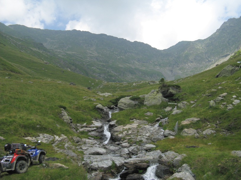
Small waterfall at the base of Balea Waterfall
Transfagarasan ends in serpentines at Cartisoara, where it meets the E68 road, between Brasov and Sibiu cities.
All these resulted in an unforgetable trip.
Great pictures you have here! Best regards from far away :)
ReplyDeleteTHANK YOU SO VERY MUCH...! I have loved this area all my life... Although I will never be able to go in person, looking at your beautiful photographs made me feel as if I was right there...! Thanks, again..!
ReplyDelete