Cindrel (or Cibin) Mountains are located in the Eastern Carpathians, in the so called Southern Romanian Carpathians, in the center-west part of Romania, at about 30 km South-West of Sibiu (Hermannstadt) city. The heighest peak of the masiff is Cindrel (alt. 2244m).
Way of access
By plane: Sibiu has international airport
By road: Sibiu -> (DN106A) -> Rasinari -> (DN106A) -> Paltinis
From Paltinis you may access the track below
Track Description
I will split the track description in 2 articles, one for each day.
For the next day track, you may access the link: Cindrel Mountains - Day Two
Shortly, the first track follows the next direction on the map:
Paltinis -> intersection with Cibinului Gorges -> Craciuneasa resort -> Niculesti Shelter -> "Refugiul de sub Iezere" ("The shelter from under the lakes") -> (end of first day).

Track Map - Day One
So, we arrived in Paltinis (alt. 1450m), nearest the old ski resort; after final checking of equipment, we started to walk North, following the old part of Paltinis resort, hoping to find the red circle marker, or the so called "Students Way"; this is a small portion of the track (aprox 5km) which descends to the Cheile Cibinului (Cibinului Gorges). Following the red circle marker, after walking through forest, we arrived after 4km at a forestry road and turned to right, then, after 1km we arrived at a cross point - to the right there are the Cibinului Gorges; here we turned left and passed the bridge to Craciuneasa (on the bridge it is written with blue paint "Craciuneasa 4km"); pay attention, because this is an unmarked track, but all you have to do is to follow the forestry road and the river, in the West direction; at about 1.5 - 2km from the bridge the forestry road passes intersects another track, with an inscription "Bradul urias de 500 ani - 1.4km" ("Huge tree, 500 years old - 1.4km"); you continue the track, until you arrive to Craciuneasa; Craciuneasa is a small but beautiful resort, we counted about 15-20 chalets; we had here a 30 mins break; in Craciuneasa also took place a wave/techno festival in summer 2010. After the deserved break, we followed the forestry road to the Niculesti shelter (about 7km from Craciuneasa resort); the oldest chalet of Craciuneasa is located at about 2km of Craciuneasa resort, somewhere on the mountain seen at the left, but we have no time to get there. The track changes direction to South-West. At Niculesti, we found a marker to Stramba Shelter (red cross marker to the right, aprox 5km), but we followed our track forward, in the South-West direction. Normally, from Niculesti we should follow the blue triangle marker, but be aware, this marker is rarely present (probably due to the fact that we walk on the forestry road). On the way, you may admire an ensamble of 2 big stones (4km of Niculesti), called by locals "La Biserica" ("At the Church"); after these 2 stones, the track encounters an abandoned wooden shelter (7km of Niculesti). Then it follows an intersection of forestry roads where you turn left; the track direction is now South; you walk on the forestry road until you find a little abandoned sheepfold; here, the forestry road ends and you have to turn right, following the blue triangle marker which becomes visible; the track climbs through forest and you should pay attention because there are many intersections - you just have to follow the blue triangle marker; after about 4-5kms from the little sheepfold you will arrive to "Refugiul Iezerele Cindrelului" (alt. 1750m), or "Refugiul de sub Iezere" ("The shelter from under the lakes"); here, the first day track ends, after about 22kms and about 7-9 hours of walking (we made aprox 8 hours);
Elevation Curve
- from Paltinis you descend from 1450m to 1000m on a distance of 5km, until the intersection with Cibinului Gorges;
- from the bridge to Craciuneasa found at the intersection with Cibinului Gorges, you easy climb (forestry road) from 1000 to 1550m on a distance of 14km, until the little sheepfold where forestry road ends;
- from the little sheepfold you climb from 1550m to 1700m on a distance of about 2.5km, until "Refugiul Iezerele Cindrelului".

Elevation Curve (Google Earth)
*
Images:

Road to Paltinis (DN106A)

Paltinis Resort (1450m)

Chalet in old Paltinis Resort

Track starts in this intersection

Track follows the red circle marker
until Cibinului Gorges

Track descends on red circle marker

Red circle marker ends at the intersection
with the forestry road to Craciuneasa
(inscription on bridge with blue paint -Craciuneasa 4km)
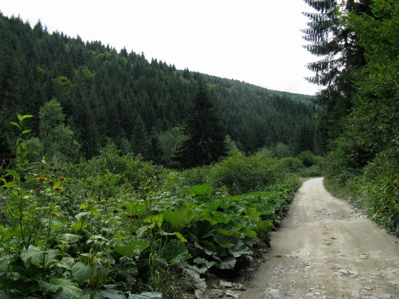
Track follows the forestry road

Abandoned bridge found at the left of forestry road

Track follows the forestry road

Intersection with another track
(inscription "Huge tree, 500 years old - 1.4km")

Cibinului river, or "Riul Mare" (Big River)

Craciuneasa Resort

Craciuneasa Resort

Craciuneasa Resort ("Wheel of Fortune")

Craciuneasa Resort

Craciuneasa Resort

Track follows the forestry road

Red cross indicator to Stramba Shelter

Niculesti Shelter

Stones and little waterfall on Big River

"La Biserica" (At the Church)

Abandoned wooden Shelter

Blue triangle marker,
rarely visible on this track portion

Forestry road intersection,
turn left here

Little abandoned sheepfold where forestry road ends
and blue marker becomes visible

Track climbing on the blue triangle marker

Following the blue triangle marker

Inscription with protected natural area of Cindrel mountains

"Refugiul de sub Iezere"
(Shelter from under the Lakes)

"Refugiul de sub Iezere"
(Shelter from under the Lakes)
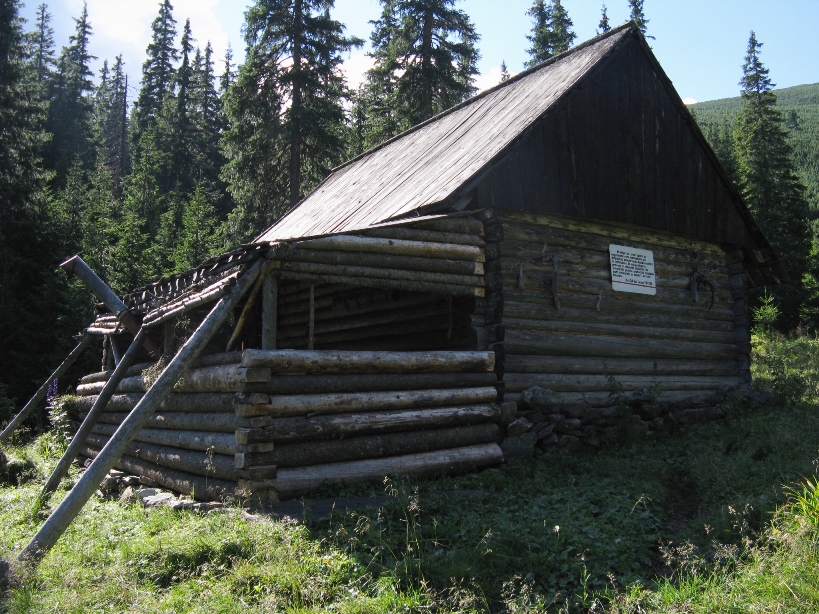
"Refugiul de sub Iezere"
(Shelter from under the Lakes)

near the "Refugiul de sub Iezere"
(Shelter from under the Lakes)

Inside the "Refugiul de sub Iezere"
(Shelter from under the Lakes)

Inside the "Refugiul de sub Iezere"
(Shelter from under the Lakes)
No comments:
Post a Comment